

The Benefits of Drone technology for Property Surveys
The surveying profession has always evolved alongside technology, and in [...]
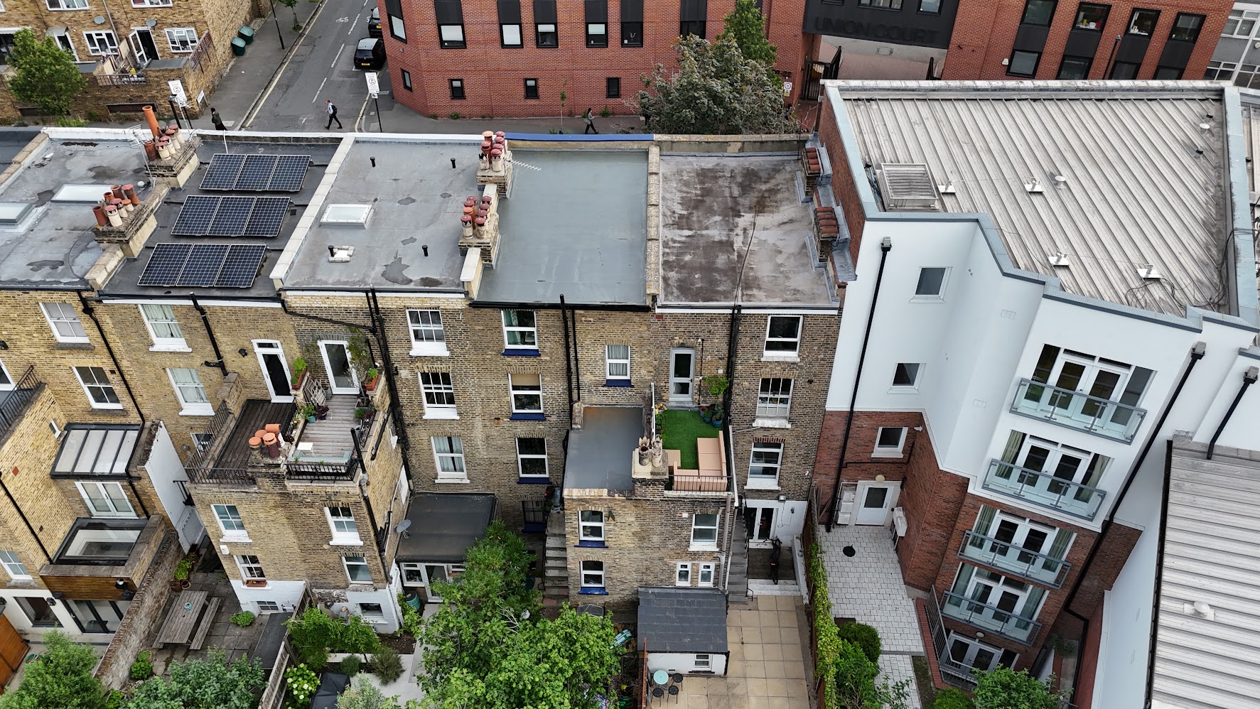
The surveying profession has always evolved alongside technology, and in recent years, drones have become one of the most transformative tools available. As a chartered surveyor, integrating drone technology into property inspections has significantly enhanced the accuracy, efficiency, and safety of the surveying process. This article outlines the key benefits of drone‑assisted surveys and why they are becoming an industry standard.
Enhanced Access and Safety
Many buildings contain areas that are difficult, dangerous, or impossible to inspect using traditional methods. Roofs, chimneys, valleys, parapets, and high‑level façades often require ladders, scaffolding, or specialist access equipment.
Drone technology eliminates these risks entirely.
- High‑level inspections can be carried out without physical access.
- Unsafe structures can be examined from a safe distance.
- Fragile roofs can be surveyed without any load placed on them.
This not only protects our surveyors but also reduces liability for property owners.
Superior Visual Data
Drones capture high‑resolution photographs and video footage that far exceed what can be achieved from ground level. This visual data provides:
- Detailed imagery of defects such as slipped tiles, cracked render, vegetation growth, blocked gutters, and deteriorated flashings.
- A permanent digital record that can be reviewed, shared, or used for future comparison.
- The ability to zoom, analyse, and annotate images for inclusion in professional reports.
For clients, this means clearer explanations, stronger evidence, and greater confidence in the findings.
Improved Accuracy and Reporting
Modern drones can be equipped with advanced sensors, including:
- GPS positioning
- Thermal imaging
- Oblique and vertical photography
- 3D modelling capabilities
These tools support:
- Precise measurements
- Thermal assessments
- Condition mapping
The result is a more comprehensive and accurate survey, particularly for large or complex properties.
Reduced Cost and Disruption
Traditional high‑level inspections often require scaffolding, cherry pickers, or specialist contractors. These methods are not only expensive but also disruptive for homeowners, tenants, and businesses.
Drone surveys offer:
- Lower overall cost
- Faster turnaround
- Minimal disturbance
- No need for access equipment or temporary works
For estate agents, property managers, and homeowners, this makes drone surveys an attractive and practical option.
Versatility Across Property Types
Drone technology is suitable for a wide range of surveying needs, including:
- Residential homes
- Commercial buildings
- Industrial sites
- Agricultural land
- Heritage and listed structures
Whether assessing storm damage, inspecting a roof prior to purchase, or documenting defects for planned maintenance, drones provide a flexible and reliable solution.
Environmental and Planning Benefits
Drones also support broader surveying objectives:
- Monitoring land boundaries
- Assessing vegetation encroachment
- Reviewing drainage patterns
- Supporting planning applications with aerial imagery
- Documenting progress on construction sites
This makes them valuable not only for building surveys but also for land and development assessments.
Drone technology has become an essential asset in modern property surveying. It enhances safety, improves accuracy, reduces costs, and provides clients with clearer, more comprehensive information. As a chartered surveyor, adopting drone‑assisted inspections ensures that every survey is carried out with the highest level of precision and professionalism.
By Jessica Guthrie
Business Strategy Director